Urban Sub Area
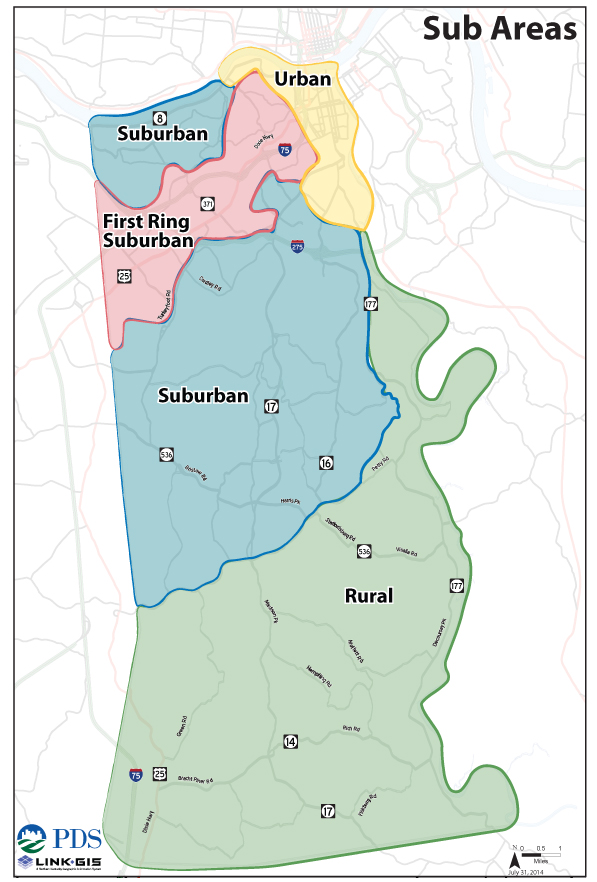 Direction 2030 introduced Sub Area planning as a formal planning element for Kenton County with the plan’s formal adoption in September 2014. Sub Areas recognize four distinct development patterns within the geographic boundaries of the county—rural, suburban, first-ring suburban, and urban. As such, each sub area has distinct needs because of their varied geographic, social, political, and economic factors. The content on this page refers to the implementation efforts within the urban sub area. More information on specific aspects of the Direction 2030 plan can be found in the Goals & Objectives and Sub Areas sections.
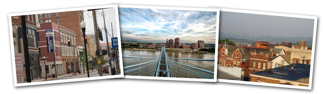
The urban sub area portion of the county is located along the Ohio and Licking Rivers encompassing the cities of Ludlow, Bromley and the urban portion of Covington including the Latonia area. With full access to urban services and utilities it contains the highest built-up development density in county featuring a wide range of land uses and development styles. Cultural amenities within the area include an extensive list of places for gathering, recreation, and higher education. Large concentrations of historical structures and sites provide the backdrop for unique and charming neighborhoods dispersed throughout the area. The urban subarea also boasts a wide variety of recreation and entertainment options which attract visitors from all over the county and region.
Implementation Progress Reports
Fall 2015
Leaves are falling in Northern Kentucky and community implementation efforts continue in the Urban Sub Area. Over the spring and summer Planning and Development Services of Kenton County (PDS) worked diligently on a collaborative project with appointed and elected officials in the Cities of Covington, Ludlow, and Bromley. The scope of the project was to inventory the existing conditions of the parks and recreation facilities within each city, focusing on recording the user’s experience of each park and grading the physical condition/appearance of equipment and facilities at each location. Following the completion of the inventory early in the summer, PDS planners and Geographic Information Systems (GIS) staff, developed an interactive map showing the location and amenities provided at each park in the urban subarea. The interactive map can be found at rivercityparks.org which also includes links to an online survey geared towards gaining meaningful input into where each city should focus new investment into their parks.
In addition to the inventory, website, and survey, PDS staff is also currently working with the City of Covington to create a plan that will make recommendations for each park located in the city. The recommendations will take into consideration the input obtained from the online survey, facilities inventory, demographic analysis of park service areas, and data obtained from PRORAGIS reports. PRORAGIS is an online software tool developed by the National Recreation and Park Association (NRPA) that allows communities across the county to enter information pertaining to their park system, which can then be used to benchmark their park system to comparable jurisdictions.
As part of the Urban Subarea Project, PDS staff is working on a collaborative project with the Catalytic Development Funding Corp. of Northern Kentucky to create a holistic interactive map of completed and potential revitalization projects in the urban subarea. While the project is just beginning, the map is will include additional information related to substantial developments in the surrounding areas, such as Gateway Community College and the location of Redbike Stations.
PDS staff welcomes the opportunity to connect with community members. If you would like to learn more about the project or provide input regarding a specific project, please contact Mike Ionna, AICP, Principal Planner at PDS.
Spring 2015
Preliminary efforts to implement recommendations from the Direction 2030 Urban Subarea element are currently in the beginning stages. Efforts include meeting with key agencies and organizations to identify projects which will provide the greatest impact across the entire subarea as well as implement the recommendations of Direction 2030. Be sure to check back often for more details on this project and ways to get involved.
Urban Sub Area Recommendations
The recommendations below were established by the Direction 2030 plan on September 4, 2014 and guide planning in the urban sub area of the county. Click here for more information on Direction 2030’s urban recommendations and other sub areas in Kenton County.
1. Recommendation:
Redevelop strategic residential, commercial, and industrial areas that are currently underutilized and have the potential for a high return on investment.
Tasks:
- Locate grants and funding sources to assist in redevelopment.
- Use a variety of historic preservation strategies and incentives to preserve vulnerable buildings and maintain the character that draws people to urban areas.
- Work with municipalities to streamline administrative and permitting processes to help attract new industries.
- Evaluate existing zoning regulations to ensure that they are conducive to redevelopment.
2. Recommendation:
Work with local jurisdictions and infrastructure agencies to address infrastructure needs in the urban area.
Tasks:
- Identify strategic areas that need infrastructure improvements.
- Evaluate the built environment to find innovative and cost-effective methods to reduce the amount of stormwater entering the system.
- Evaluate the roadway system and parking needs to improve access to the urban core.
- Repair and replace sidewalks and streetscape elements as needed, Use the asset management program to identify areas that may need sidewalk repairs and streetscape improvements.
3. Recommendation:
Identify assets that contribute most to community identity.
Tasks:
- Collaborate with local jurisdictions and other entities that work on urban development to identify assets that contribute most to the community’s identity and strategize how to capitalize and build upon these assets.
- Identify needed amenities in the urban core that will retain and attract new residents.
4. Recommendation:
Improve and increase alternative modes of transportation.
Tasks:
- Coordinate with local jurisdictions to determine feasibility of increasing mass transit in the urban area.
- Identify locations for the installation and enhancement of bike facilities.
- Assist local municipalities in securing funding for alternative transportation facilities.