Rural Sub Area
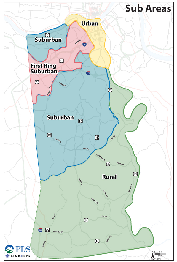 Direction 2030 introduced Sub Area planning as a formal planning element for Kenton County with the plan’s formal adoption in September 2014. Sub Areas recognize four distinct development patterns within the geographic boundaries of the county—rural, suburban, first-ring suburban, and urban. As such, each sub area has distinct needs because of their varied geographic, social, political, and economic factors. The content on this page refers to the implementation efforts within the rural sub area. More information on specific aspects of the Direction 2030 plan can be found in the Goals & Objectives and Sub Areas sections.
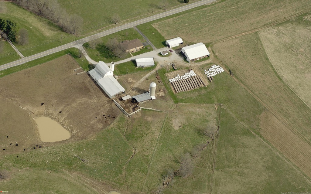
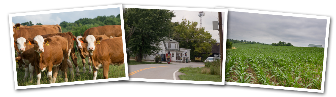
The rural sub area is the portion of the county south and east of Highway 16. The area contains a number of farms (both large and small) along with homes on lots of an acre or more. While properties in the area can range from approximately 200 acres to 1 acre, the average lot size is approximately 10.5 acres.
2019-2020 Recommended Land Use Review
Over the past two years, staff has been working with numerous jurisdictions throughout Kenton County to update Direction 2030’s recommended land use. The project is now working to review recommended land use for Unincorporated Kenton County.
Click here to learn more about the project and its recommendations.
Implementation Progress Reports
Efforts to implement recommendations from the Direction 2030 Rural Sub Area element are currently in action. Click on one of the progress reports below to find out more.
Fall 2016 Progress Report
Winter 2015-16 Progress Report
Fall 2015 Progress Report
Summer 2015 Progress Reports
Spring 2015 Progress Report
Sub-Committees
 Services

Works on public services such as water and cable connection. The group has met with Richard Harrison of the Northern Kentucky Water District to discuss bringing water to everyone in the southern part of the county. They have also collaborated with Tim Broering of Telecommunications Board of Northern Kentucky to discuss increasing the number of southern Kenton County residents receiving TBNK broadcasting. The chairperson is Amy Heeger.
Roads
Focuses on the maintenance, and safety of the roads in the southern part of the county. This sub-committee has met with Kenton County Police Chief Brian Capps and Public Works Director Nick Hendrix to discuss ways to make the roads safer and improve the maintenance. The chairperson is Bill Schneider.
Zoning
Researches the regulations and ordinances that govern the southern half of the county. This sub-committee is working with PDS staff to investigate various ways to use regulations and ordinances to maintain the rural heritage of the southern half of the county. The chairperson is Kathy Donohoue.
Agricultural Heritage
Examines how to encourage farming and promotes agritourism. They are working with Dan Allen of the Kenton County Agriculture Extension Office in finding ways to maintain the farms currently operating in the county and increase the amount of farming in the county. The chairperson is Scott Daniels.
Rural Sub Area History
 Group Formation

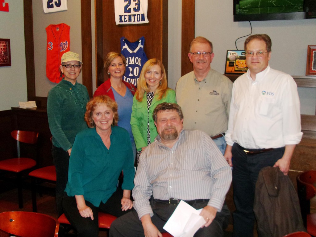
Direction 2030 efforts associated with the rural sub area first began in November 2011. Planning and Development Services of Kenton County (PDS) facilitated a round table discussion public meeting to listen to residents and help establish goals and objectives for the plan. This meeting sparked the interest of a small group of south Kenton County residents who began meeting regularly, bringing their neighbors together and discussing issues regarding the rural area. This group continued to meet quarterly with support from Kenton County Fiscal Court and PDS and became known as the South Kenton County Citizens Group. The group played a significant role in crafting the goals and objectives for the rural sub area.
The South Kenton Survey
The group wished to learn what other residents thought about the future of the rural area and conducted a survey to gather ideas, concerns and desires. With the support of Kenton County Fiscal Court, PDS, and the Kenton County Cooperative Extension office, approximately 3,100 surveys were mailed to all households in the area in January 2014. A response rate of three-hundred fifty responses was needed for the survey to be considered statistically significant; the community came together and returned more than a 1,000 surveys.
The survey was developed by Dr. Lori Garkovich of the University of Kentucky who has extensive experience dealing with rural issues throughout the Commonwealth. During the preliminary planning process one of the main themes raised by residents was the need to preserve the rural heritage of the area. To capture the varied perceptions of rural heritage, additional questions regarding what defines rural heritage were also included so as to provide a variety of options. Respondents could choose from farms, large homes, small stores, large office buildings, and retail. Also included were questions pertaining to respondents’ satisfaction with existing roadways, Internet access, employment centers, access to retail, and residential development. The survey also included demographic questions that provided general information on the respondents.
The results of the survey show that the residents of the rural sub area want to keep the area rural and to keep agriculture viable. A large majority of the residents are currently satisfied with their access to commercial and retail stores, and they do not want to see residential subdivisions development on agricultural land.
Click here for more information on the survey .
Moving Forward
Following completion of the survey and Direction 2030’s adoption by the Kenton County Planning Commission (KCPC), the South Kenton County Citizens Group continued to meet and discuss issues concerning the southern part of the county. The group instituted four targeted sub-committees to research and create implementation strategies for the Rural Sub-Area recommendations in Direction 2030. These sub-committees are researching: Zoning, Roads, Services, and Agricultural Heritage. Each of these sub-committees corresponds to issues raised in the recommendations of Direction 2030.
Rural Sub Area Recommendations
The recommendations below were established by the Direction 2030 plan on September 4, 2014 and guide planning in the rural sub area of the county. Click here for more information on Direction 2030’s rural recommendations and other sub areas in Kenton County.
1. Recommendation:
Align current policies and regulations to highlight and preserve the rural heritage of southern Kenton County.
Tasks:
- Consider the effect land use policies in southern Kenton County will have on the elements of rural heritage, property values, property rights, and housing prices.
- Develop model zoning regulations, based on the overall community value, that appropriately balance the need for growth and preservation in southern Kenton County.
- Evaluate cultural and recreational opportunities that are appropriate in scale to the community.
2. Recommendation:
Coordinate with appropriate agencies to assess the need and impact of extending services into rural areas.
Tasks:
- Work with the South Kenton Citizens group to develop a prioritized list of services needed.
- Encourage collaboration between the South Kenton Working Group and the South Kenton Citizens Group to investigate the needs, feasibility, and financial solutions in extending services.
3. Recommendation:
Modify regulations to accommodate the expanding range of modern agricultural activities in southern Kenton County.
Tasks:
- Determine local, state and national trends in agricultural production and related regulations.
- Continue community dialogue regarding agriculture and identify regulatory barriers.
- Evaluate and promote regulations pertaining to agri-tourism.
- Remove barriers that inhibit economic growth and viability of agriculture operations.
4. Recommendation:
Continue to support efforts and determine additional programs needed to promote agriculture operations.
Tasks:
- Promote educational opportunities for farm operators and agri-tourism.
- Encourage outreach to younger generations to get involved in agricultural programs and activities.
- Develop marketing programs to promote agri-tourism.
5. Recommendation:
Rural commercial and industrial development policies need to be tailored to align with the Recommended Land Use Map and community preservation, scale and values.
Tasks:
- Evaluate the current lists of permitted uses and recommend changes to better reflect the needs of rural communities.
- Work with rural communities in the U.S 25 corridor to examine the desire and feasibility for commercial and industrial zoning as identified in the recommended land use map.
- Evaluate the 5 acre minimum area for a freestanding zone.
- Evaluate the need to locate churches and other institutional uses only along arterial and collector streets.
6. Recommendation:
Improve safety along rural roads.
Tasks:
- Identify problem areas and coordinate with the appropriate agencies to create solutions.
- Maintain existing roadways and provide better shoulders rather than develop new roads.
- Promote the installation of appropriate speed limit and marketing signs.
- Identify funding sources and apply for grant application assistance.
- Adopt rural road standards within the Kenton County Subdivision Regulations.